
The difficult equation between rapid development and the protection of unique ecosystems is brought to the fore by the Strategic Environmental Impact Study (SEIA) under preparation and the Special Ecological Assessment Study for the new Pegeia Local Plan.
The study, which was carried out by I.A.CO Environmental & Water Consultants Ltd on behalf of the Department of Town Planning and Housing, records the dramatic demographic trends of the area and proposes strict embankments to prevent environmental degradation.
The Plan introduces new Protection Zones (Da1) around the perimeter of the Pegeia State Forest and in urban green areas.
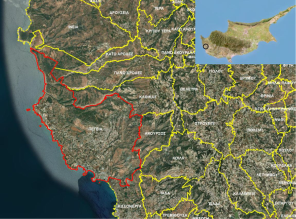
At the same time, Environmentally Sensitive Areas (ROP) are defined with strict protection limits that include the Protection Zones and the Tourist Zones T3b (Aspros Potamos area) and T5d (Sea Caves). In these zones, it is expressly forbidden to exceed the building coefficients through the transfer of the coefficient or other urban planning incentives.
For all the provisions of the Plan and for the mitigation of the impacts, the SEIA introduces a set of horizontal and specialized measures such as the preparation of a specific ecological study for any project that may affect the areas of the Natura 2000 network.
For tourist or specialized developments at a distance of less than 500m. from the Natura 2000 boundaries, the Urban Planning Authority is obliged to consult with the Environmental Authority on the necessity of submitting a Special Ecological Assessment Study.
Pegeia borders and incorporates some of the most valuable ecosystems in the Mediterranean:
• The Akamas Peninsula which is home to dozens of protected habitat types, rare species of flora (endemic species of the Red Book) and important birdlife.
• The Special Area of Conservation (SAC) of Koile – Mavrokolympos, which is also affected by the Plan and is under protection.
• Particular emphasis is placed on the Marine Protected Areas (MPAs) that extend along 10 km of coastline to Lara (Ineia). This area is internationally recognized as a Specially Protected Area of Mediterranean Interest (SPAMI) under the Barcelona Convention, being a vital habitat for sea turtles (Caretta caretta and Chelonia mydas) and the Mediterranean monk seal (Monachus monachus).
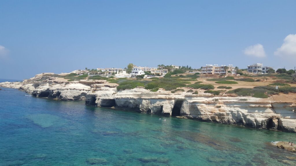
For the protection of the coasts, it is proposed that in Zone T5d1 (Sea Caves) the structures should be located as far away from the coastline as possible, and the intermediate zone should be converted into a green area with the exclusive use of local vegetation.
The Strategic Study concludes that the Pegeia area is under intense development pressures, which, if left unchecked, will cause irreversible damage to the landscape and biodiversity, particularly due to zoning extensions and cumulative effects.
Expansion of Tourist Zones
It is proposed to designate 3 new Tourist Zones, with a total area of 115.2ha, located within a Land Consolidation Area (existing Z1), which corresponds to an increase in Tourist Zones by approximately 39%. The northern area, with an area of 13.7 ha, is located between Agios Georgios and Kafizi avenues, where only the construction of tourist villages, tourist villas and houses with low development coefficients (T5d) will be allowed.
The other two areas are a natural extension of the existing tourist area of Coral Bay. In Zone T1c2 located on Agiou Georgios Avenue and not adjacent to the coastline, although increased development factors will apply, however, the construction of hotels, which is the most developed development, will not be allowed.
On the contrary, in Zone T5d1 which is adjacent to the coastline, it is possible to build a hotel, but with a very small building and coverage factor (only 15%), thus promoting milder developments.
All 3 areas consist mainly of crops with relevant agricultural properties, while it is noteworthy that there is a relatively large number of scattered individual houses in the area.
The relevant amendments to the proposed Plan are:
• Expansion of Residential Zones by 59.5ha of which 50.4ha within the Land Consolidation Zone Z1.
• Expansion of Tourist Zones by 115.2 ha, within Land Consolidation Zone Z1.
• Determination of three new areas for the location of Specialized Developments outside the Development Limit, with a total area of 67.3ha.
The main cumulative impact of all the amendments to the Local Plan concerns the loss of 165.6ha of arable land within Land Consolidation Area Z1.
The siting of Specialized Developments in the 3 areas outside the Development Boundary is not associated with the loss of fertile land (these areas are not irrigated and are not arable land), but they cumulatively contribute to the impact of the landscape and the increase of soil sealing.
In total, existing Residential and/or Tourist Zones with an area of 54.6ha are converted into Protection Zones, and therefore, the final area that changes use with permitted development amounts to 120ha.
Residential Zone Extensions
It is proposed to create two new Residential Zones along Agios Georgios Avenue, with a total area of 50.4ha within the Land Consolidation Area (existing Zone Z1), and another small area (0.5ha) within the Rural Zone (C3). In the two areas that fall under a Land Consolidation Area, there is a small number of existing properties, while they mainly consist of arable land.
The mixed Zone Ga4/Ka10 can only be developed if a road network or an Urban Land Consolidation Plan is initially constructed, and until then it will remain as a Rural Zone. Residential Zones are growing by only about 6%.
The planned projects
Due to the intense residential and tourist demand observed in the area of Pegeia in recent years, a significant number of organized residential developments are currently under construction or are planned to be executed, both along the coastal front and further north within and around the residential core.
Expansion of an existing havara quarry: The expansion of an existing havara quarry with an area of 7,273m2 and a capacity of 75,000m3 was approved.
Paphos Marina: The aim of the project is to develop a Marina in the Paphos area, which will function as a marina, with a total capacity of approximately 1,000 berths for boats of various sizes. At the same time, several supporting land uses will be gradually developed, which are a mixture of residential centers (coastal villas, tourist village, maisonettes, etc.), commercial (restaurants, sports centers, gyms, aquarium, etc.) and cultural uses (cultural center, church).
Configuration of a coastal pedestrian walkway/bicycle path: The project concerns the construction and operation of a coastal promenade within the boundaries of Pegeia, with the aim of composing a single linear coastal functional park which will create a walking, sports and recreation area along the coastal front, for the residents and visitors of the area. The starting point is the bed of the river Mavrokolympos and the finish is the port of Agios Georgios, with a total route of 13km.
Configuration/regeneration of the central square of Pegeia: The project concerns the configuration of the square area of the Fountain of Pegeiotisses and the beautification of the surrounding central fabric of Pegeia.
Projects in Akamas National Forest Park
• Creation of three junctions in Aspros Potamos, which will also be an entrance junction to the SAR, Skali Toxeftra and Avakas.
• Reconstruction of two bridges at the White River and at the beginning of Toxeftra (Avakas River).
• Improvement of the road network Aspros Potamos-Lara.
