CONDITIONS OF INCREASED RAINFALL IN CYPRUS IN THE NEXT FORTNIGHT - RISK OF FLOODING EPISODES - WHICH OTHER COUNTRIES ARE AFFECTED - Filenews 20/3
The medium-term climate forecast of the Department of Meteorology for the period from 19 to 31 March 2026 records increased chances of rainfall in the eastern Mediterranean region, including Cyprus, with estimates talking about rain heights above normal levels for the season.
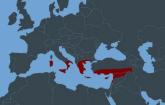
According to the medium-term climate forecast of the Climate Watch Advisory Group of the World Meteorological Organization (WMO), the period from March 19 to 31, 2026 is expected to be characterized by rainfall above normal levels for the season in parts of the central and eastern Mediterranean, including Cyprus.
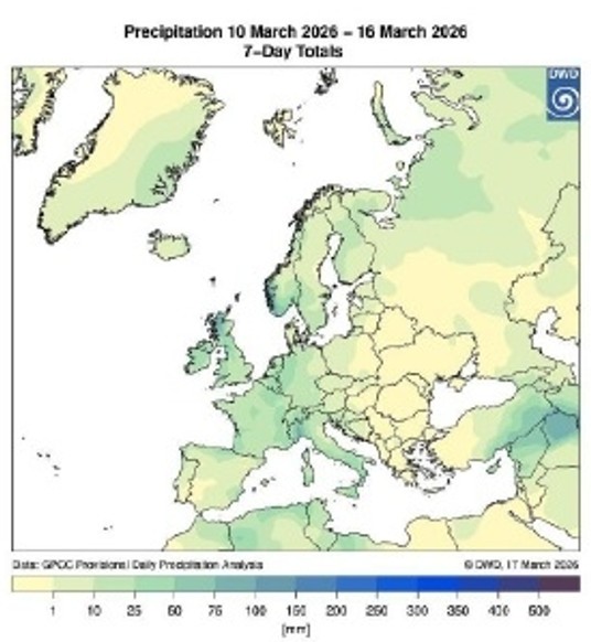
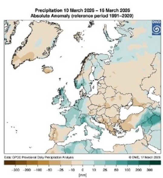
Weekly climate analyses indicate positive precipitation anomalies, with total weekly precipitation heights generally expected to be between 25 and 75 mm, while higher amounts may be recorded in exposed areas. The probability of wetter than normal conditions is estimated to exceed 90% during the first week of the forecast period, while for the second week it ranges between 70% and 90%.
For Cyprus, these conditions may lead to a temporary improvement in soil moisture and hydrological conditions, while locally the occurrence of heavy rainfall in short periods of time is not excluded. In cases of intense phenomena, local flooding episodes may also be observed.
According to the press release, despite these comparatively favourable data, the hydrological situation remains challenging, as water supplies are still at low levels after a prolonged period of drought. Therefore, the rational use of water remains essential.
The Department of Meteorology is monitoring the evolution of conditions and will issue relevant updates where required.
Among the countries expected to be affected by the increased rainfall are Italy, Greece, Turkey, Cyprus, Lebanon and Syria.
Prevailing Meteorological Conditions
The atmospheric circulation over northern Europe is characterized by a strong westerly flow, with trough and cold air masses from the northern parts descending into east-southeastern Europe and the simultaneous development of a ridge of high geodynamic heights in western and central Europe, favouring more stable conditions. At the same time, in the wider Mediterranean region, weaker but dynamically important structures are formed, with cyclonic curvature in the upper troposphere and the presence of detached lows, which act as mechanisms to enhance instability.
On the surface, Europe shows a clear differentiation between the northern and southernmost regions, where the northern regions show strong barogradient and frontal activity while the southernmost regions show conditions of instability. Particular emphasis is placed on the Eastern Mediterranean, where the combined effect of a weak barometric low, upper cyclonic flow and accumulation of cold air mass in the upper atmosphere creates a favourable environment for the occurrence of local rains and storms. The area is affected by warmer and relatively humid air masses, with the result that conditions remain mild in temperature but with an increased possibility of instability compared to the rest of Europe.