BBC News 8 June 2023

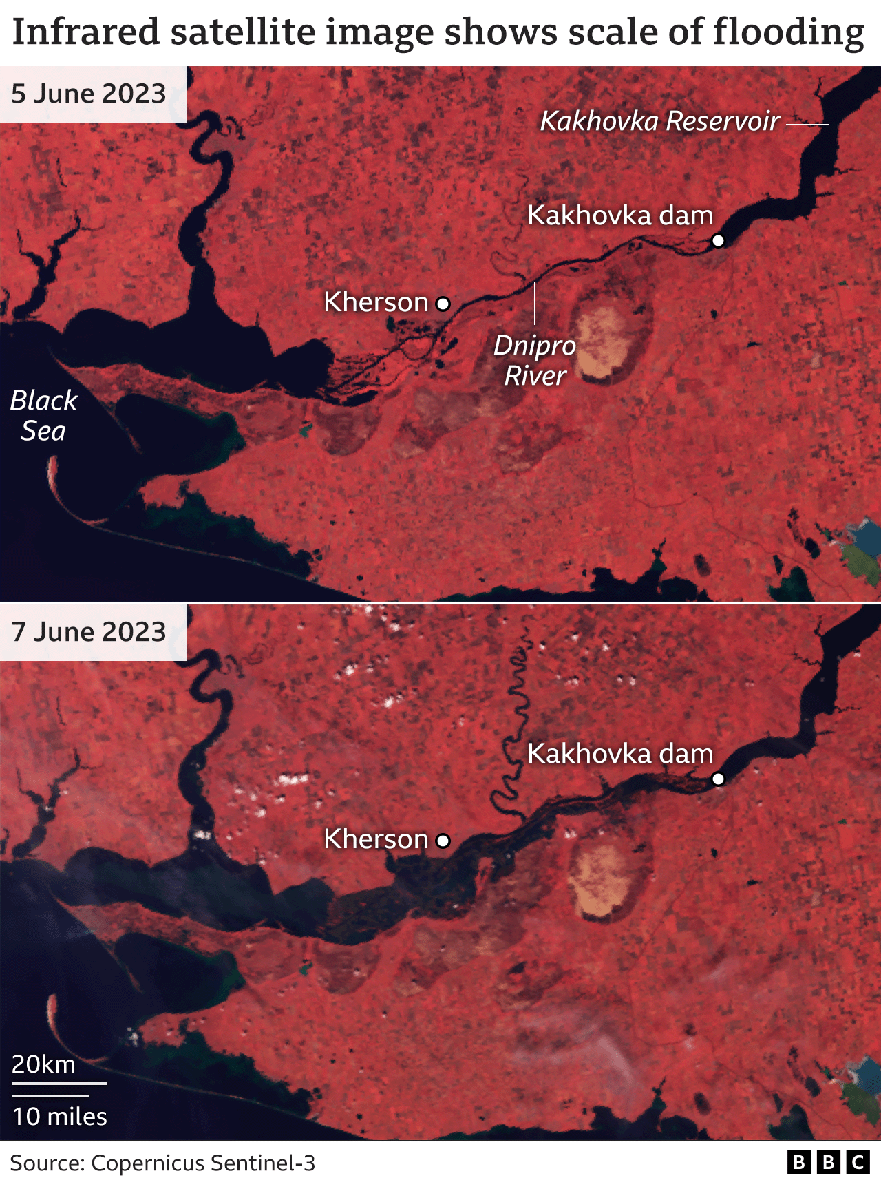
The scale of the floods caused by the destruction of a huge dam in the Russian-controlled area of southern Ukraine on Tuesday is starting to become clear.
In closer images the water levels can be seen reaching the roofs of most buildings in the town of Oleshky, on the Russian-controlled side of the river just a few miles from Kherson, with many completely submerged.
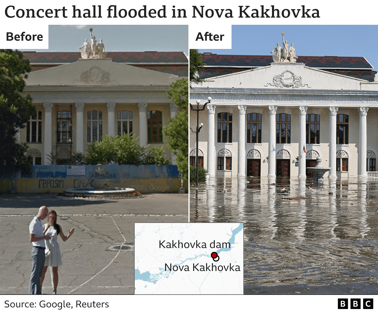
The dam is next to the city of Nova Kakhovka, in the Kherson region, and holds back a reservoir that is so huge locals call it the Kakhovka Sea - because you cannot see the opposite bank in certain places.
Images from Nova Kakhovka on Tuesday showed buildings surrounded by floodwaters hours after the dam was destroyed.
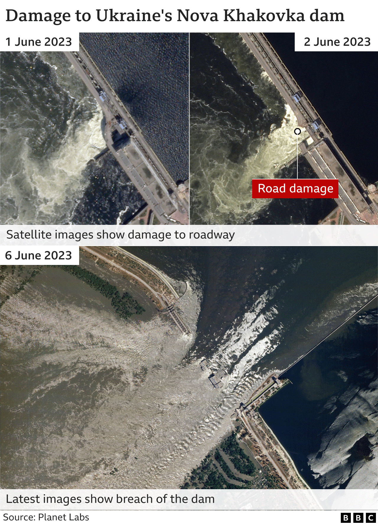
It is unclear when exactly the dam was first damaged or how it happened, but satellite images suggest its condition had deteriorated over a number of days.
A road across the dam can be seen to to be badly damaged from 2 June, but there did not seem to be a change to the flow of the water until 6 June when the breach of the wall and collapse of nearby buildings can be clearly seen.
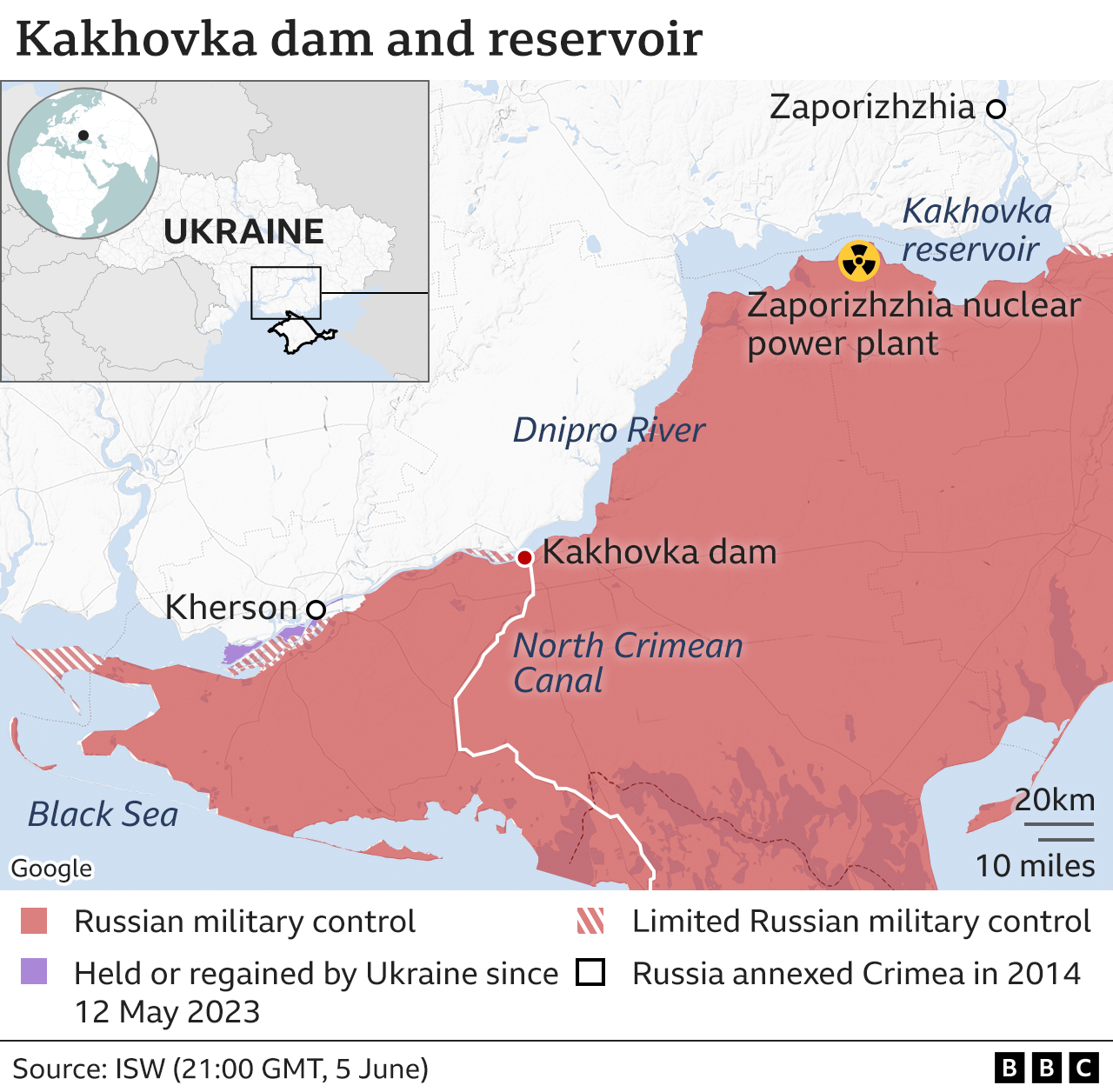
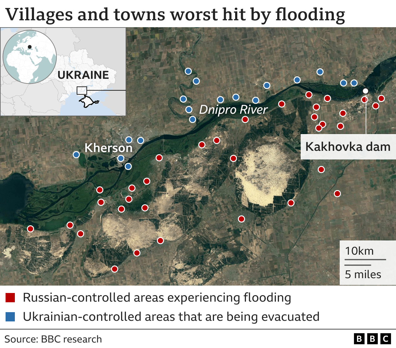
The entire south bank of the Dnipro River as far as the eastern end of the vast Kakhovka reservoir has been occupied by Russian forces since the invasion last year.
Apart from the flooding, the dam's destruction has raised concern about the state of the Zaporizhzia nuclear power station, about 130km upstream.
The reservoir provided cooling water to the plant, which is also under Russian control, but the reservoir is now emptying rapidly.
However, the International Atomic Energy Agency (IAEA) says there are alternative water sources to keep the plant cool.
Some reports suggest that water levels may be dropping in the town of Nova Kakhovka, closest to the dam, as the vast reservoir behind it empties.
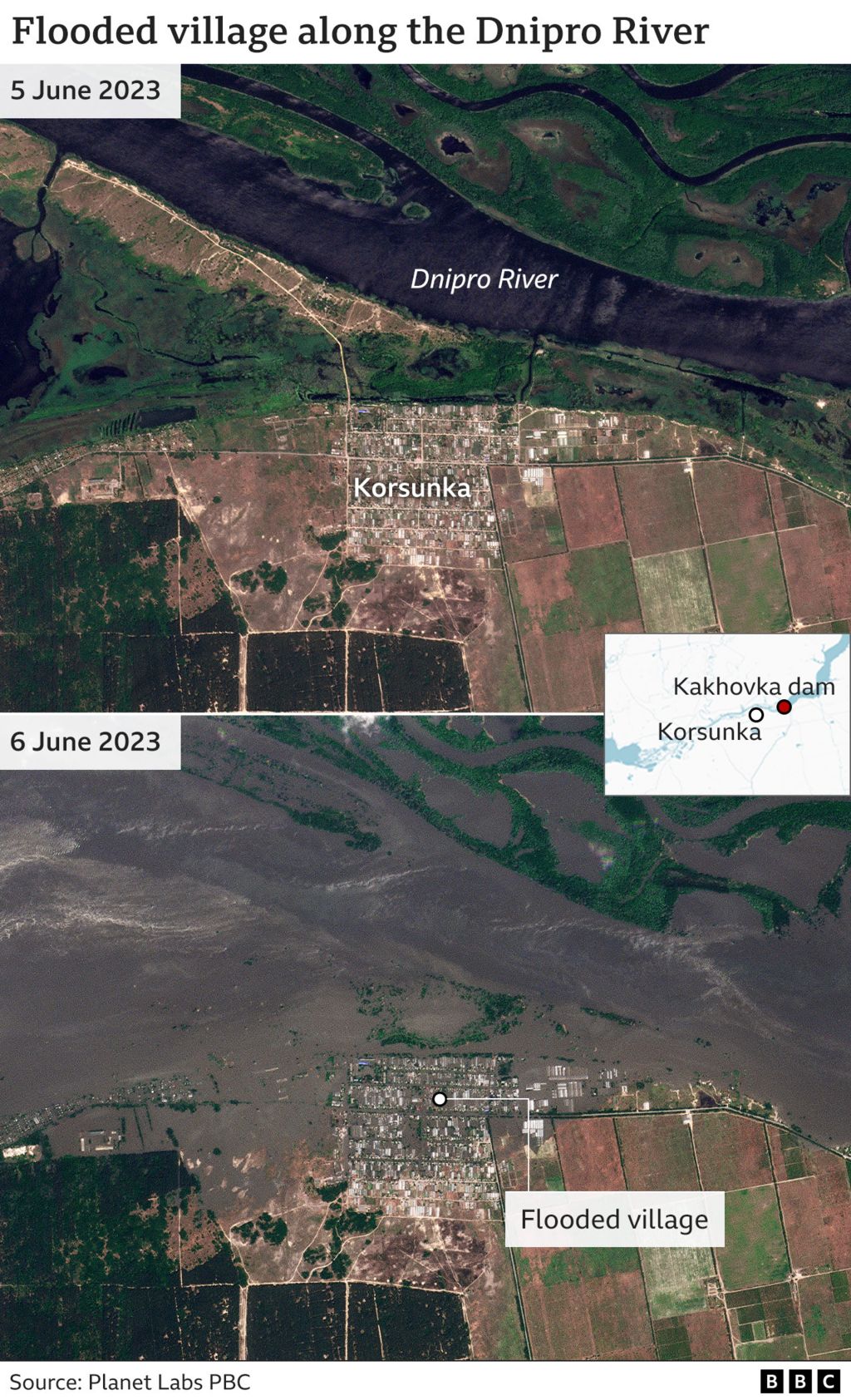
But the city's Russian-appointed mayor Vladimir Leontyev said the village of Korsunka - about 15km west of the dam - was completely under water, with flooding up to roof level in three other villages.
Ukraine and Russia both say they have evacuated more than 1,000 people each.
However, Ukrainian officials say more than 40,000 people - 17,000 in Ukraine-held territory west of the Dnipro River and 25,000 in the Russian-occupied east - need to leave.
The Ukrainian authorities have released a list of settlements they want people to leave and details of some where rescue teams have been working on the west side of the river, while Russian-installed authorities have given details of places they say are flooded on the side of the river they control.
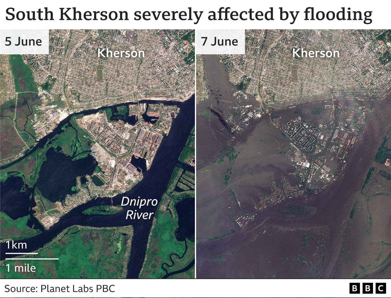
And Kherson itself had already seen heavy flooding on Wednesday morning - even though Ukrainian authorities were not expecting water levels to peak until the end of the day.
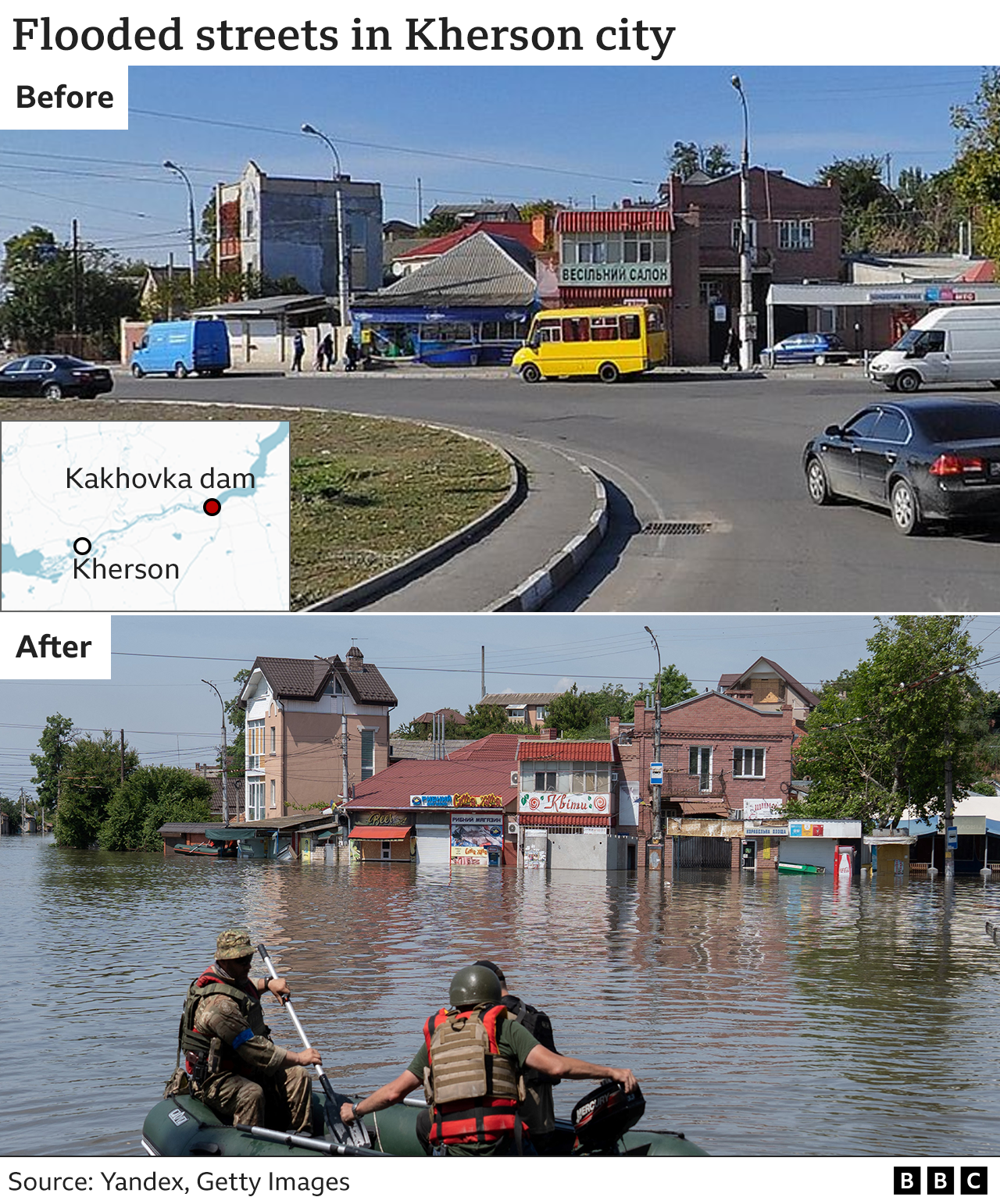
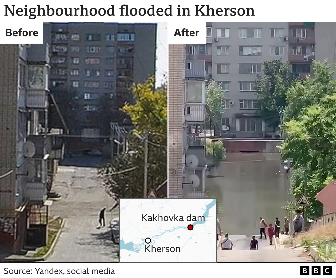
Once again the true scale becomes clearer from satellite images that show just how much of the city has been hit by the deluge.
It is just the latest tragedy to hit the city since Russia's invasion - occupation, liberation after heavy fighting and shelling most days.
And the BBC's James Waterhouse, who is in the city, says it has changed the atmosphere there, with morale lower. People have had enough, he says.
Reporting and graphics by Chris Clayton, Tural Ahmedzade, Daniele Palumbo, Erwan Rivault, Kate Gaynor, Gerry Fletcher & Filipa Silverio