BBC News 20 May 2022 - by the Visual Journalism Team

Russian forces are continuing their slow advance in the east of the country after using heavy firepower to weaken Ukraine's defences.
Here are the latest developments:
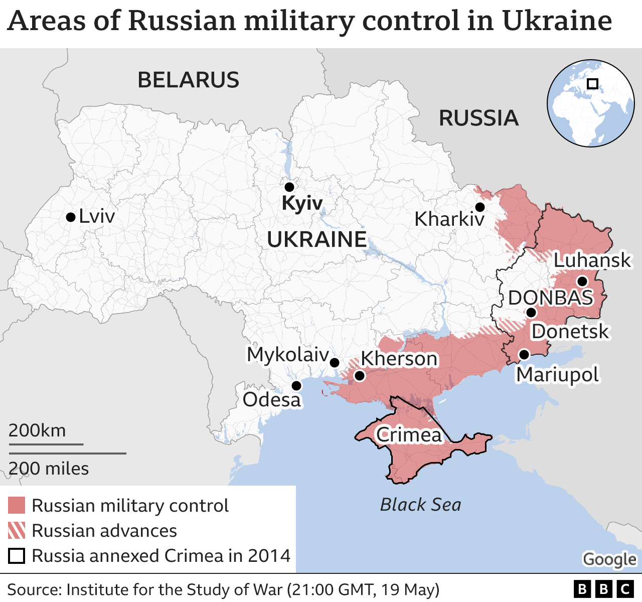
Russia invaded Ukraine on 24 February, but Ukrainian forces retook large areas around Kyiv in early April after Russia abandoned its push towards the capital.
Following the withdrawal from the north of Ukraine, Russia has refocused its efforts on taking control of the east and south of the country.

Slow Russian advances continues in east
Russian officials have said its forces are fighting for the "complete liberation" of the Donbas, which broadly refers to Ukraine's eastern regions of Donetsk and Luhansk, where Russian-backed separatists held significant territory before the invasion.
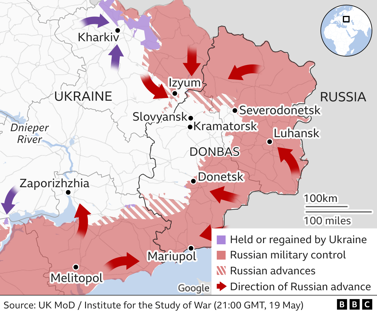
The focus of Russian forces in recent weeks has been around the city of Izyum and to the east towards Severodonetsk.
Ukrainian forces have been successful in repelling recent Russian advances around Izyum, according to the Institute for the Study of War (ISW).
But Russian troops have made progress in the Luhansk region, taking control of Rubizhne and Popasna as they move towards their target of Severodonetsk.
To the north, however, Ukrainian forces have now pushed the majority of Russian forces away from Kharkiv, the country's second largest city.
The ISW reports that Russian troops withdrawn from around Kharkiv are now being redeployed to the Donetsk region.
War in Ukraine: More coverage
- ON THE GROUND: One man's anti-war protest in a tiny Russian town
- ANALYSIS: Russia's laser weapon claim derided as propaganda
Russia targets full control of south
Russian forces initially made rapid gains in the south, with their main objective being the creation of a land corridor between Crimea, which it annexed in 2014, and areas held by Russian-backed separatists in Donetsk and Luhansk.
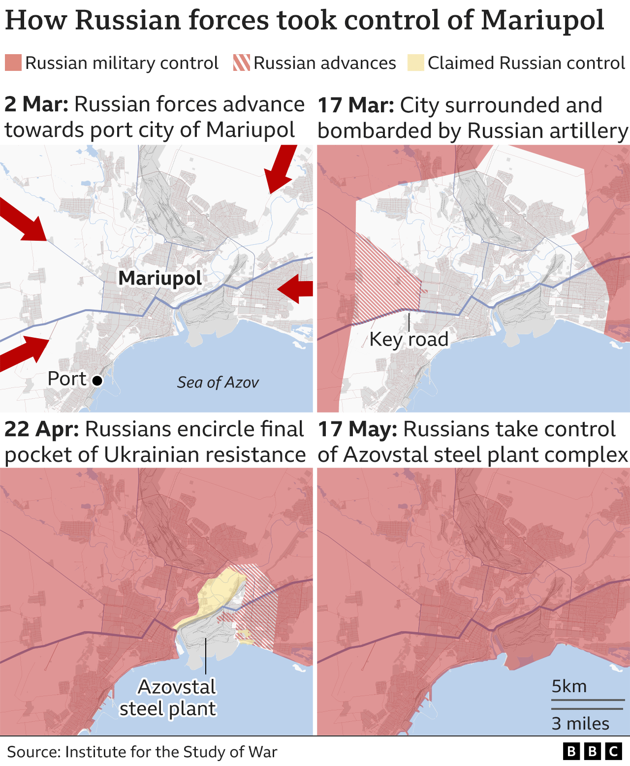
But strong resistance from Ukrainian forces near Mykolaiv in the west and in Mariupol in the east significantly slowed Russian advances.
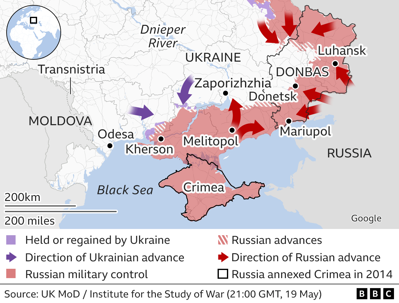
Russia has now taken control of the port city of Mariupol, which its forces encircled at the start of March, after more than two months of fierce Ukrainian resistance.
Several hundred Ukrainian troops who were holed up in the Azovstal metal works factory in the south of the city have now surrendered.
To the west, Russia had aimed to take control of Odesa and cut off Ukraine's access to the Black Sea, but its forces were blocked by a staunch defence in Mykolaiv and forced back towards Kherson by a Ukrainian counteroffensive in March.
In the Black Sea, Russia is continuing efforts to reinforce its troops on Snake Island. The roughly 16-hectare (40-acre) rocky outpost is owned by Ukraine but was taken over by Russian forces in February.
By David Brown, Bella Hurrell, Dominic Bailey, Mike Hills, Lucy Rodgers, Paul Sargeant, Alison Trowsdale, Tural Ahmedzade, Mark Bryson, Zoe Bartholomew, Sean Willmott, Sana Dionysiou, Joy Roxas, Gerry Fletcher, Jana Tauschinsk, Debie Loizou, Simon Martin and Prina Shah.
About these maps
To indicate which parts of Ukraine are under control by Russian troops we are using daily assessments published by the Institute for the Study of War with the American Enterprise Institute's Critical Threats Project.
To show key areas where advances are taking place we are also using daily updates from the UK Ministry of Defence and BBC research.
The situation in Ukraine is fast moving and it is likely there will be times when there have been changes not reflected in the maps.