Filenews 5 September 2021 - by Angelos Nikolaou
Professor of Natural Disaster Management at the University of Athens, Efthimios Lekkas, was in Cyprus, immediately after the devastating fire in the mountainous areas of the Limassol and Larnaka districts, to offer the experience he has gained in Greece and worldwide with direct actions for the environmental rehabilitation of the areas. The professor of the National and Kapodistrian University of Athens submitted his report on flood protection, anti-flood and anti-corrosion interventions and measures for the protection of groundwater and surface water to the Minister of Agriculture.
Efthimios Lekkas explains to "F" the reason he came to Cyprus, his findings from the consequences of the devastating fires and the measures he proposes so that flooding phenomena do not cause problems in the settlements. The professor points out that the risk of flooding is real, such as severe erosions and landslides.
Professor, you have carried out operational missions all over the world to capture the major natural disasters. What brought you to Cyprus?
At the University of Athens we maintain a laboratory that has been a pioneer for 30 years worldwide in the management of natural disasters. We have developed remarkable research and scientific activity. It is the only laboratory in Greece and my title is professor of disaster management. We have a lot of experience of all the catastrophic phenomena, heavy rainfall, fires, earthquakes, tsunamis, volcanoes, etc.
We have made more than 60 missions around the world in cases of major disasters and I am also president of the Earthquake Planning and Protection Organization.
Based on the experience we gained from all these phenomena and especially from fires in Greece such as in Mati, in the Peloponnese, in Chios, in Kythira, in Gerania, in Neapoli of Laconia, but also based on large fires around the world as in the Amazon and Australia, we have gained a very good experience in risk management issues, environmental hazards, immediately after a large fire. Specific environmental impact management investigations have been carried out in these areas.
Your descent to Cyprus was at the invitation of the Minister of Environment...
I contacted the Minister of Agriculture and the Minister invited me to come. This is the second time I have come here to Cyprus. The first time was two days after the July 3 fire.
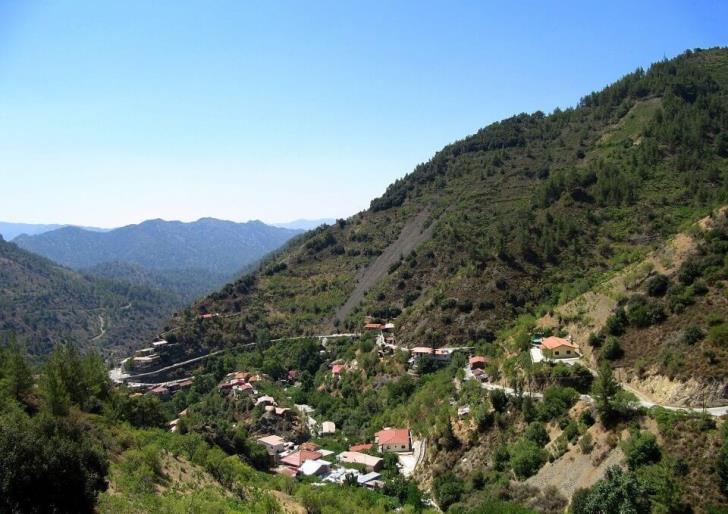
What we should say here is that first of all the fire developed at a very critical point. It is the hub of geo-environment and bio-environment in Cyprus, that is, it is a nodal area, an umbilical cord between mountain complexes and lowland complexes.
With special flora, with particular morphological conditions, with the waters, with human activities that develop on them. That is, it is a fire in a nodal space, it is not a fire that could and should not directly interest us.
During your stay in Cyprus, you toured the fire-stricken areas of the districts of Larnaca and Limassol. What are your findings?
We went to the area with the ministry officials and saw what the devastating fire left behind. In the on-the-spot surveys carried out in the affected areas we found the evolution and impact of the forest fire on the population (human losses, evacuation of endangered communities), on fauna and flora, on buildings, vehicles and infrastructure.
After such a fire, we are essentially moving on three axes.
- The first axis is to reduce the physical hazards that follow a fire.
- The second axis is to enable the area to recover in relation to the environment and,
-The third pillar is economic aid, the social assistance to be given to the inhabitants, which is a matter for the government, of course.
We, in relation to the first axis, the axis of the management of accompanying risks after a major fire, have done a very good job, especially on issues that arise.
Floods, sudden floods, erosions in the ground, landslides, groundwater aquifer contaminations, and surface water, all these follow a great fire like this. The area therefore needs special monitoring that will lead to its recovery.
So we saw on the spot the problems and the solutions that can be implemented, in order to protect the region from conspiring catastrophic phenomena and to recover the region in the best possible way.
Rather, we choose the case of applying small stone dams into the hydrographic network, i.e. in rivers and streams. This is preferred over logs applied in other cases. Also, what we have proposed are some projects to prevent erosion in the area, and some projects just before the reservoirs, so as to protect them from possible flooding or from the materials that are thrown away. We moved all over the affected area and I formed a very good picture and we specialized the actions to the minister.
There is a risk of developing post-fire phenomena in the affected area. Especially after such a devastating fire, the risk of flooding and erosion is particularly increased, since the mountain sides have been left bare. The professor gives his own explanation:
Flooding is bound to affect if rain falls on the area. But with the first heavy rainfall we must be ready to face the flooding phenomena. Flood protection works must be carried out. Another important point to see is how the region will recover environmentally. There should be major human interventions to be cleared, the cutting of trees should be done immediately, nature should be left to regenerate on its own. Measures and actions that need to be taken so that the area is not affected environmentally and does not suffer damage.
A report to the Ministry of Agriculture analyzes the risk of post-fire phenomena in the affected areas, including landslides, flooding, erosion and desertification, which are characterised by a high potential for adverse conditions and damage.
In this case a rapid transmission of the fire was observed, in 5 hours 55 sq. km were destroyed. This is the most devastating fire since the beginning of the Republic of Cyprus.
The new element of fire is its severity. The speed was too high and the spread was done with intensity. It does not always happen in other fires, meteorological conditions and morphology. But it is not something strange or rare. Within a very short time the fire was running at 130 km an hour and expanded at high speed. In this case there is difficulty in extinguishing, we do not have time, the firefighters cannot approach and there are no ways to stop the progression of a fire.
From the day after the devastating fires in the communities of Arakapas, Eptagonia, Oras, Agioi Vavatsinias, Melini and Odos, the government proceeded to the inventory and assessment of the damages to private premises, in order to examine the case of granting financial assistance to those affected. From the data recorded, damages were done to more than 100 premises, vehicles and agricultural machinery. It was found that there were cases of unlicensed premises, which mainly concerned privately owned residences of permanent residence. The professor analyzes the phenomenon of the presence of individual dwellings in the forest.
It is an issue that we face many times in Greece, as the fire in Mati was from residences for agricultural use in the forest. You can't do anything with zoning, since they help agricultural work. But it carries great risks when these dwellings are on the outskirts or in the forest. Not only will they be damaged, but they have flammable elements that transmit even faster the spread of the fire.
It is very difficult to react immediately. We weren't able to do anything. There are terrible difficulties in flying means as well. A plane cannot get close to darkness. In an extensive fire front even when you extinguish it, when winds blow 6-7-8 Beaufort fire is transmitted and makes leaps to other areas. As a result, new fronts are created that are often not easy to approach. From the outside, when one notices it, one thinks it is easy. But if you don't live the facts up close you can't have an opinion. It is very difficult to deal with the situation even at international level
Much is said about how climate change affects and exacerbates natural disasters. More emphasis is therefore needed on environmental protection in order to place greater emphasis on prevention.
When money is made available for prevention, we anticipate disasters, but if I may say this, Mr Nicolaou: for the last three years we have been trying ourselves to understand what is happening. In other words, we, as scientists, often find that we are overtaken by events. We took risk for granted on some issues. Today we have two or three risks together, all these phenomena are due not to climate change - climate change to have required climate change for hundreds of years - I would say to the climate crisis. They are directly linked, they are accelerated, if we design them in new ways, it is very difficult to deal with the situation even at international level. What we are doing is setting the new standards. We are even seeing advanced countries such as Germany finding it difficult to deal with natural disasters.
In addition to the damage to people's property, the great fire also caused a huge environmental disaster. The fire in the mountainous areas of Larnaca and Limassol destroyed 55,000 acres, while respectively the fire in the Gerania Mountains burned 52,000 acres. They are both devastating fires, in terms of burnt forest area and in a question to the professor to the professor with which fire in Greece is compared the fire in the mountainous areas of Cyprus, he gave the following answer:
No fire can be compared to others since they are composed of a multitude of different parameters. Perhaps the fire in the Geraneia Mountains that occurred 2 months ago was also similar to that of Cyprus.
What are the main effects of the fire on the ground and which ones on the hydrological balance?
The impact on the soil is great. They destroy the organic but also some inorganic elements which are essential to be productive and fertile. In addition, the erosion caused, destroys the soil itself revealing the rocky background which does not have the ability to develop vegetation. The magnitude of these changes in the soil depends on the intensity of the fire, the ratio of low and high vegetation, the size of the burned area and the frequency of forest fires.
What are the main impacts on the water body?
The main effects of fires and especially of forest fires on the quantitative status of water bodies (surface and underground) are largely due to the disruption of the hydrological balance of the wider region. Usually after a large fire there is a qualitative and quantitative degradation of the water elements with all that this implies for the economic and social development of an area.
Who is Who
Professor of Dynamic Tectonic Applied Geology & Natural Disaster Management in the Department of Dynamic Tectonic Applied Geology of the Department of Geology and Geo-environment of the National and Kapodistrian University of Athens, Efthimios Lekkas, is known to the public for the way he acts after natural disasters not only in Greece, but also worldwide. With a rich CV he has given hundreds of lectures, as a guest speaker, in Greece and abroad, as well as as a guest professor at universities in Germany, England, Turkey and New Zealand. He has written and published 12 scientific books and notes. The books titled "Natural and Technological Disasters" and "Geology and Environment" are the only ones in Greece and are taught in seven Higher Education Institutions.
He is the President of the Earthquake Planning and Protection Agency (OASP), Director of the Laboratory of Research and Management of Natural Disasters, President of the European Centre for Earthquake Prevention and Forecasting of the European Commission, Director of the Postgraduate Program "Strategies for Environmental, Disaster and Crisis Management, President of the European Centre for Earthquake Prevention & Forecasting, President of the Research Committee of the Institute of Technical Studies of the European Commission OASP's seismology and earthquake engineering structures, national representative at the Third U.N. Global Conference on Disaster Risk Reduction in Sendai, Japan (2015).
He has more than 300 scientific publications in the fields of Tectonic and Dynamic Geology, Environmental Geology, Seismotectonics, Earthquake Proofing, Natural Disaster Management, Waste and Water Resources Management, Geotechnical Engineering, Environmental Spatial Planning, etc. Many of the publications concern research papers in Japan, Taiwan, Italy, Turkey, India, in Algeria, Indonesia, Thailand, Pakistan, China, Haiti, New Zealand, Japan, Nepal and Mexico.
He has participated – coordination in the operational missions for dealing with the disasters of Kalamata, Kyllini, Milos, Pyrgos, Grevena, Aigio, Corinth, Athens, Lefkada, Kythira, Western Peloponnese, Andravida, Oichalia, Kallidromo, Istiea, Rhodes, Kefalonia, Lefkada, Neapolis, Ioannina, Amyntaio, Lesvos, Chios, Kos, Kythira, Zakynthos, Mandra, Attica and Eastern Attica, Zakynthos, Plomari, Lesvos, Chania, Chalkidiki, Athens and Kineta.
Furthermore, he undertook operational coordination of National and International Search and Rescue Missions, technical support, scientific research and humanitarian aid in the large-scale disasters in San Jose (Central America), Kobe (Japan), Dinar (Turkey), Umbria (Italy), Adana (Turkey), Chi-Chi (Taiwan), Izmit and Duzce (Turkey), Gujarat (India), Apulia (Italy) in Bingol (Turkey), Boumerdes-zemmouri (Algeria), in the countries of the Indian Ocean (Indonesia, Thailand, India, Sri Lanka), in Kashmir (Pakistan), in Sichuan (China), in Aquila (Italy), in Port au Prince (Haiti), in Christchurch (New Zealand), in Tohoku (Japan), in Van (Turkey), in Emilia Romagna (Italy), in Kathmandu (Nepal), in Amatrice (Italy), in Ischia (Italy), in Mexico City (Mexico), in Hualien (Taiwan), in Kilauea (Hawaii), Cusco (Peru), Palu and Sunda Strait (Indonesia), Durres (Albania) and Doganyol (Turkey).